
Rural structures
Baich Y Wern Sheepfold
Baich Y Wern Sheepfold has a concrete structure and the remains of an old Cambridge 55 car just outside the sheepfold, in the Claerwen Valley.…
Read the storyFrom abandoned farmhouses and mountain sheepfolds to the remains of vanished communities: follow the stories still written into the landscape.
Discover the placesAcross the Elan and Claerwen valleys, ruined buildings tell the stories of former residents, farmers, workers and families. This archive brings together original photographs, site visits, map references and historical notes. Choose a place to begin exploring.
Search the recorded locations or browse by type.
Baich Y Wern Sheepfold has a concrete structure and the remains of an old Cambridge 55 car just outside the sheepfold, in the Claerwen Valley.…
Read the story
The Baptist Chapel, now submerged beneath Caban Coch Reservoir. Map Ref SN91070 63929
Read the story
Remains of Blaen Coel Farm. Map Ref SN89050 64030
Read the story
Ruins of Blaen Methyn associated with Blaen Methyn mentioned in documents of 1580, 1585 and 1621 (Archaeologia Cambrensis 1880, pp. 40, 45,…
Read the story
Remains of Blaen Mwyro Sheep Fold near Llyn Gynon. Map Ref SN79355 64147
Read the story
Remains of Blaen Y Cwm Long Hut. Short distance off the old Aber Mountain Road. Map Ref SN85536 75624
Read the story
Remains of Bryn Glas Long Hut and Shelter off the old Aber Mountain Road, near Afon Elan.
Read the story
Bryniago, Claerwen Valley. Former home of John and Elizabeth Price. The house was abandoned when there were plans to build Cil-Oerwynt Dam…
Read the story
A group of longhouses and huts in the Claerwen Valley ranging from Bronze Age to Medieval.
Read the story
Cerrig Cwplau Sheep Fold and a group of long huts in the Claerwen Valley.
Read the story
Remains of Clettwr Troedrhiwdrain Farmstead, 13m x 5m of mudstone & quartz construction. Map Ref SN86960 68901
Read the story
Craig Llanerch Cawr barn on the hill above Llanerch Cawr. 8m x 6m. Map Ref SN89820 61260
Read the story
Remains of Cringyn Cottage near Tynllidiart. Map Ref SN90660 65790
Read the story
Cwm Clyd Farm. The stone building is the original house with an outside toilet. The black building is believed to have been erected for the…
Read the story
Old ruin of what may have been a Hafod above Cwm Clyd, Claerwen Valley. Long banks run near the old ruin. In the distance are peat cuttings and…
Read the story
Site of Cwm Coel House, not much to see. Normally under Garreg Ddu. It was a farmhouse with a tall chimney. Map Ref SN9062 6413
Read the story
The estate of Cwm Elan, containing the Elan Valley mansion, was purchased in 1792 by Thomas Grove. It was described then as “10,000 worthless…
Read the story
Cwm Elan Lodge was located in Cwm Elan and is now submerged beneath Garreg Ddu Reservoir. Photos courtesy of Mary Connelly Map Ref SN91071 64315
Read the story
The remains of a possible water storage pit or a swimming pool. If it was used for storing water, it may have been for the mill that was at Cwm…
Read the story
Remains of Cwm Nant Y Fald Enclosure, just above Esgair Y Ty House. 11m x 4m Map Ref SN89757 72528
Read the story
Site of Dol Folau Railway Siding.
Read the story
Dol-Faenog House, now under Pen y Garreg Reservoir. Map Ref SN91580 66820
Read the story
Dol-folau before the valley was flooded, together with later photographs of the remains when water levels were low. Map Ref SN91331 65648
Read the story
Remains linked with Dol-y-Mynach, including the demolished house, barn and a nearby building which may have been connected with the railway.
Read the story
Remains of a sheep fold or shelter near Domen Milwyn. Map Ref SN81254 72260
Read the story
Remains of Esgair Beddau House, not far from Lluest Aber Caethon. Map Ref SN86410 68640
Read the story
Esgair Ganol is up the Rhiwnant Valley. Remains of a Medieval Platform, Shelter and a Bronze Age Cairn with Drygarn Fawr in the distance. Map…
Read the story
Listed as Esgair Gris Long House but may be a disturbed cairn, with a few upright stones. Not far from Craig Goch Dam. Map Ref SN8870 668470
Read the story
A medieval or early post-medieval upland settlement complex, possibly in the hafod tradition. Remains of several rectangular stone buildings as…
Read the story
Remains of an Esgair Gyncog round hut and long house.
Read the story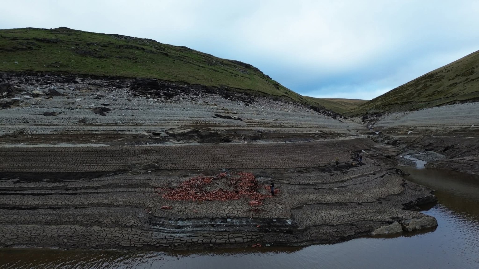
Esgair y Gader Cottage stood in the Claerwen Valley and is now normally hidden beneath Claerwen Reservoir. During exceptionally low water…
Read the story
Esgair y Ty pillow mounds and house on Esgair y Ty. A medieval rabbit warren with well-preserved pillow mounds, together with evidence of a…
Read the story
Remains of Fuches Sheep Fold. Map Ref SN86080 68480
Read the story
Remains of Garreg Ddu before the dams and what still remains today. Map Ref SN91032 63861
Read the story
Site of Garreg Ddu Navvy Huts. Normally submerged under Caban Coch Reservoir. Map Ref SN
Read the story
Medieval long houses and a hut near Claerwen Dam.
Read the story
Remains of Garreg Naw Llyn Long Hut. Map Ref SN79775 70307
Read the story
Remains of Gro Bach under Caban Coch Reservoir. Map Ref SN92060 63560
Read the story
Remains of Gro Isfa under Caban Coch Reservoir. Map Ref SN92080 63640
Read the story
Gro Uchaf before the valley was flooded. The barn on the right was moved to Clearwen Farm. Map Ref SN91764 63068
Read the story
Walls, footpaths and a bridge normally submerged under Caban Coch Reservoir.
Read the story
Remains of Hafod Allt Coch Barn. Map Ref SN9081 6774
Read the story
Remains of Llanerch Llwyn, a deserted farmstead above Pen Y Garreg Reservoir. Map Ref SN895 680
Read the story
Remains of Llanerch Ty Newydd House near Tynllidiart. Map Ref SN90910 65500
Read the story
Historic photographs and surviving ruins of Llanerchi Long House and Llanerchi Barn in woodland above Nantgwyllt Church.
Read the story
Lluest Aber Caethon is a short distance from Craig Goch Dam. It is a 19th century farmhouse with farm buildings. One of the chimneys is leaning…
Read the story
Ruins of Lluest Calettwr House. Remains of a mid-late 18th century mudstone and quartz house, a short distance from Lluest Aber Caethon. Map…
Read the story
Lluest Cwmbach was a Post Medieval house, believed to have been abandoned in the 1950s. The building was converted into a mountain bothy in…
Read the story
Remains of Lluest Pen Rhiw. It was a medieval long hut. A summer-house or dairy (lluest) associated with Nannerth-ganol, first documented in…
Read the story
Small hill farm now submerged by Craig Goch Reservoir. Map Ref SN89560 70400
Read the story
Remains of Lluest Wen just off the old Aber mountain road, listed as Lluest Tre Hesglog, Cwmdauddwr, Rhayader. Ruined structure approximately…
Read the story
Remains of Lluest y Gadair, a former post-medieval house in the Claerwen Valley. It was locally known as Lluest Abram due to Abram Davies…
Read the story
Llwydnant Long Hut, a post-medieval long hut in the Claerwen Valley. Map Ref SN87735 62283
Read the story
Llwyn Dale, a post-medieval house a short distance from Rhiwnant Farm. Once a pub when the mines were open. When the owner couldn't get the…
Read the story
Enclosure 10m by 9m overall. Earth and stone bank 3.5m wide and 0.5m high. Map Ref SN8956 6359
Read the story
Ruins of Moelfryn Barn and Moelfryn Hafod above Dolymynach Dam.
Read the story
Ruins of Nant Gris Sheepfold, very likely to have been a longhut before been altered to a sheepfold, approximately 9m x 5m, not far from Craig…
Read the story
Nant Gwyllt Church, submerged under Caban Coch Reservoir. It was a small church. Map Ref SN91809 63939
Read the story
Possibly the remains of Nant-gwyllt Cottages, photographed on 10/08/2022. Unfortunately there are no known earlier photographs here from before…
Read the storyPossibly the remains of Nant-gwyllt Cottages, photographed on 10/08/2022. Unfortunately there are no known earlier photographs here from before…
Read the story
Ruins of Nant Hesgog Sheepfold, 6m x 3m. Map Ref SN91176 69147
Read the story
Nant Y Car Farm up the Claerwen Valley. The farm was deserted due to the construction of Dol y Mynach Dam, which was a shame due to Dol y…
Read the story
Medieval long huts and a possible unrecorded hut in the Claerwen Valley.
Read the story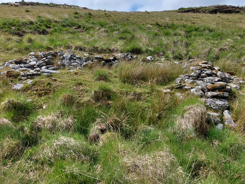
Nant Yr Iau Enclosure Map Ref SN85145 64314
Read the story
Nantgwyllt House was demolished and now lies under Caban Coch Reservoir. The original house of the Powell family was of grey stone, long and…
Read the story
Nanty Postdy Bridge, also known as Horse Bridge. Remains of an old bridge just downstream of Dolymynach Dam, normally submerged under Caban…
Read the story
Old construction shed near Craig Goch Dam, with the old railway lines still visible. Map Ref SN89220 68716
Read the story
Old footbridge under Craig Goch Reservoir, not far from the Hirnant. It is called Pontbren Lloc-ddu and is locally known as Pwll Coon. Photo…
Read the story
Possible quarry and railway cutting near Pant Tawel.
Read the story
Pant y Beddau Hafod and associated remains in the Claerwen Valley. Map Ref SN83773 64955
Read the story
Pant y Blodau was a small house, now submerged beneath Caban Coch Reservoir. Map Ref SN91734 62678
Read the story
Pant Y Cerdin, known locally as Penebw, a post-medieval house on Y Glog. Map Ref SN9166 6628
Read the story
Remains of Pant Y Llyn House, connected to Crugyn Ci Quarry. Map Ref SN93571 68885
Read the story
Remains of Pen Cae Haidd House. Map Ref SN9080 6242
Read the story
Remains of Pen Cae Mynydd, not far from Blaen Coel. Map Ref SN89662 64245
Read the story
Rhiwnant Sheepfold, Map Ref SN8767 6010, and Rhiwnant Hafod. Map Ref SN8763 6005
Read the story
The Stone Dressing Yard before the valley was flooded. Map Ref SN913 646
Read the story
Ruins of Trawsnant Sheep Fold. Map Ref SN90222 73263
Read the story
Remains of Ty Nant House under Pen y Garreg Reservoir. Map Ref SN9019 6727
Read the story
Remains of Ty'n Y Ffald near Tynllidiart. Map Ref SN90700 65680
Read the story
Remains of Ty'n y Pant house, one of six houses built in the Elan Valley for the City of Birmingham Water Works. Only four remain: Marchnant,…
Read the story
Tyrpeg y Mynydd (the Mountain Turnpike), on the Old Aber Mountain Road, also known as Hillgate or Llidiart y Mynydd, was once a turnpike…
Read the story
A unrecorded hut or post-medieval cottage, it's like two buildings joined together, about 15m x 5m overall, with a central wall at least 1m…
Read the storyNo places match that search. Try another name or type.
The original extended illustrated archive has been retained, including site descriptions and photographs that may not yet have their own individual page.
Mapped sites are based on recorded Ordnance Survey grid references. Select a marker for more details.
Zoom and drag to explore. Ordnance Survey Leisure mapping is used when a site-restricted OS key has been configured; otherwise OpenStreetMap is displayed.